Warm and windy conditions continue Thursday evening ahead of the big cold front out to our west. The main line of storms with this system is actually going to move through ahead of the front which is a couple hours behind it. Look for a line of heavy rain with gusty winds as we go through the evening. The strongest part of this line will be in the northern areas.
After that much cooler weather moves in tonight and for Friday. Winds will switch around to the north behind the front with temperatures dropping to around 40 by tomorrow morning to the north with mid to upper 40s to the south.
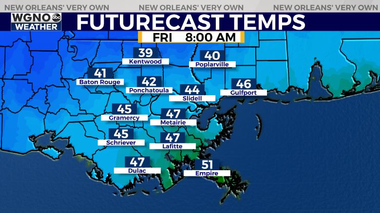
Friday looks breezy with low to mid 50s through the day which means you will want to have the jackets out at the parades tomorrow night.
The weekend looks good with low 60s Saturday and upper 60s on Sunday. Saturday night will still be on the cool side but the good news is no rain through the weekend.


