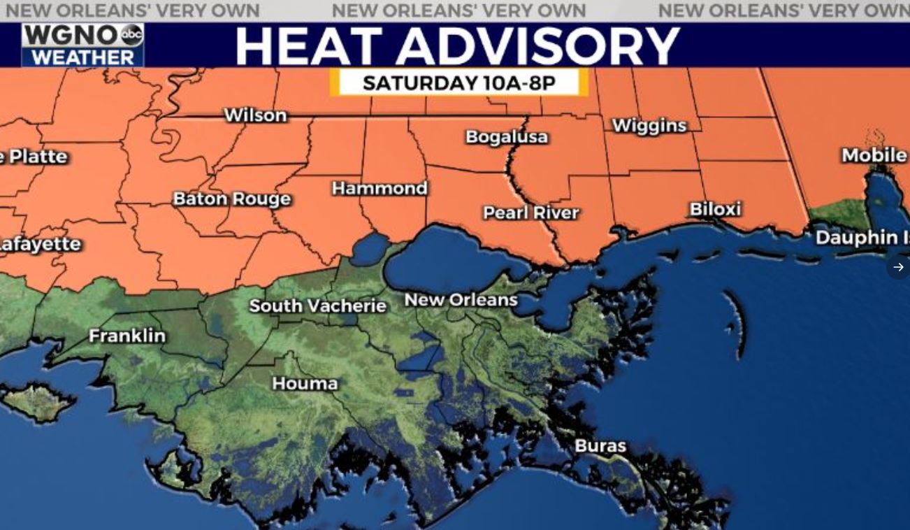
Saturday looks to be similar to today in terms of rainfall coverage. The best chance will be along and south of I-10. Temperatures will warm up with the lower rain chances. Highs will be back in the low to mid 90s on Saturday, especially the northern half of the area. A heat advisory is in effect for these areas meaning that we could see heat index values of 108 or above.
By Sunday a small front moves into the area. Right now it looks like this comes in early Sunday morning with showers and storms. After that the front remains draped over the area for several days. This will lead to higher rain chances of 50-70% across the area for Sunday afternoon through at least Wednesday.
Because of the rain temperatures will likely stay cooler with mid to upper 80s for highs each day.


