
Some big changes are on the way overnight! A cold front pushing across the area will bring a steep drop in temperatures later Saturday evening into Sunday morning.
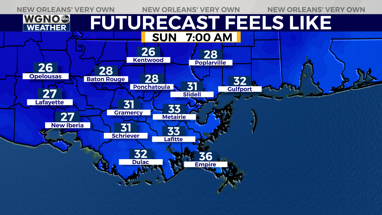
Look for temperatures to fall into the 50s by 9 p.m. before eventually dropping into the lower 30s along the Northshore with upper 30s on the Southshore on Sunday morning.
Highs Sunday will only top out in the mid 50s with another light freeze will be possible in the colder spots on Monday morning.

Temperatures will quickly rebound into next week under sunny skies. Highs return to the low 60s by Monday and the mid 60s by Tuesday.
Wednesday and Thursday will be even warmer – but it comes with a high chance for rain. The latest models show scattered showers in the second half of the day Wednesday with widespread rain on Thursday. Rain chances are at 50% Wednesday and 80% on Thursday.


