Drier air and slightly cooler temperatures are now being felt along the Gulf Coast following the passage of a weak cold front this morning. This evening, expect temperatures to cool quickly under clear skies as high pressure settles into the region.
Now through Thursday morning, overnight low temperatures will drop into the low to mid 60s along and north of I-12. South of Lake Pontchartrain, temperatures will be in the upper 60s to low 70s. Daily high temperatures will remain slightly below average for this time of the year, topping out in the mid 80s.

Rain chances will stay very low through the rest of the week, but humidity will start to increase on Friday as moisture begins flowing in from the Gulf of Mexico. By the weekend, temperatures will return to the upper 80s, but it will feel more like the low 90s.
In the tropics, the National Hurricane Center is watching two areas for potential development. The NHC gives a tropical wave located over the central Atlantic a 40 percent chance of formation over the next 5 days. This system is forecast to head toward the Caribbean and may become a tropical depression by the end of the week.
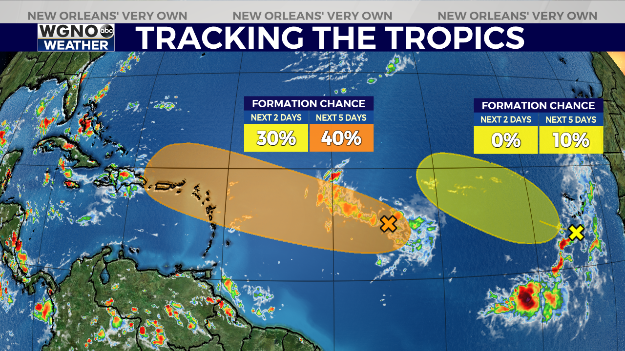
The NHC also gives a tropical wave off Africa near the Cabo Verde Islands a 10 percent formation chance. However, this chance appears to be decreasing as the wave enters an environment less favorable for development.


