NEW ORLEANS (WGNO) — An area of low pressure is expected to develop over the Gulf of Mexico this week, and where it goes will have significant implications on what impacts we will see locally.
Most models show the low developing over the north-central Gulf by Tuesday. This will likely lead to rough seas and coastal flooding for Southeast Louisiana and South Mississippi.
A Coastal Flood Warning is in effect until 7 a.m. Thursday for the Gulf Coast and area lakes where inundation of 1 to 3 feet can be expected.
Some locations may see some shower activity late Tuesday night, but there is a better chance for rain on Wednesday once the low begins to lift north.
Similar to some tropical systems, we may see bands of rain rolling over the same areas, which may lead to flooding in low-lying areas or locations with poor drainage.
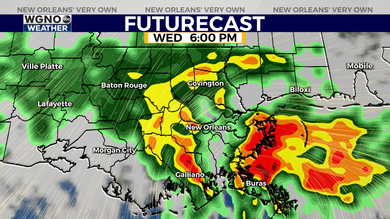
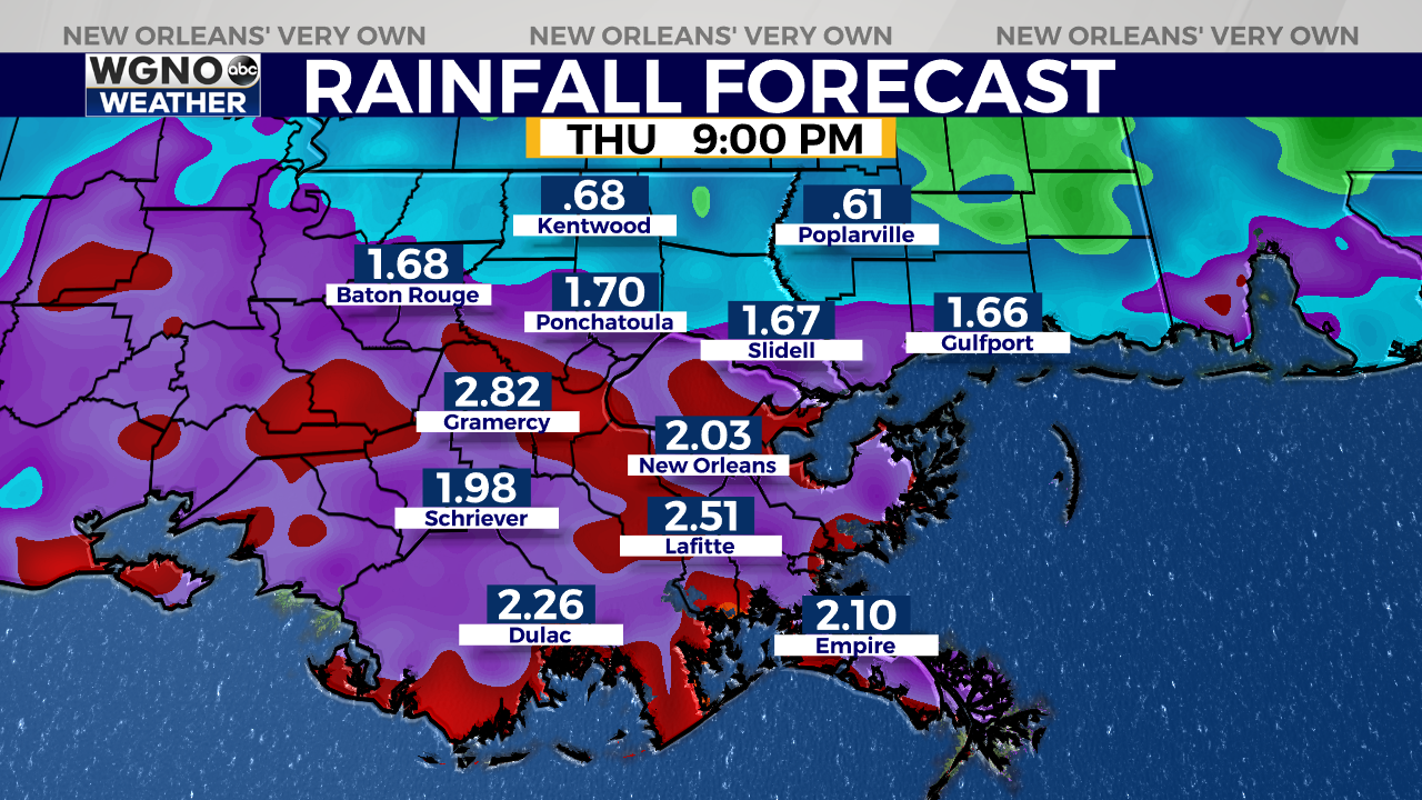
Higher rainfall totals from this system will be farther south, closer to the Gulf Coast, where 2 to 4 inches of rain will be possible. Farther north, 1 to 3 inches of rain can be expected with isolated higher totals.
This system looks like it will move out of the area by late Thursday m


