New Orleans’ forecast for Saturday has included shower activity. This is the theme again in these upcoming evening hours before chances increase significantly overnight through Sunday morning.
On radar, expect our increasing severe weather threat at dawn until your afternoon after lunch.
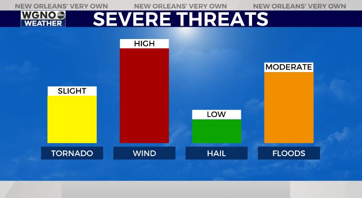
Right now, heavy rain capable of producing localized street flooding as well as gusty winds and a few tornadoes are my primary concern.
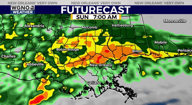
A warm front lifts north, bringing thunderstorms across Northshore and Southshore locations around day break. Have ways you can receive warning information on hand incase one alert is issued while sleeping.
Conditions improve once that system progresses east, then the much colder air filters in behind cold front number two since last week.
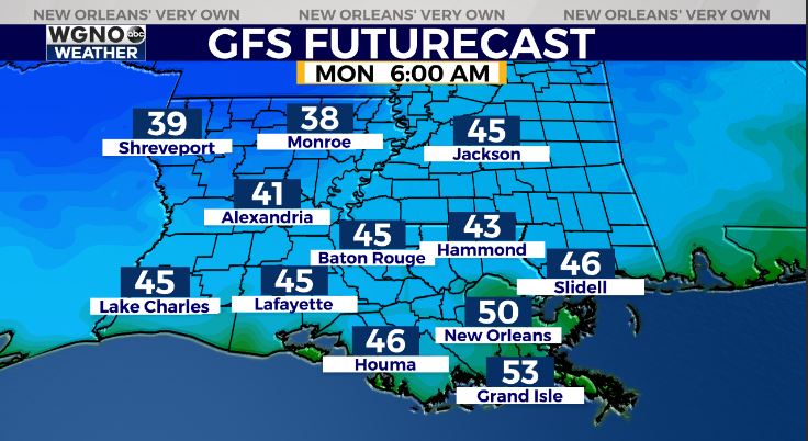
Monday, anticipate an incredibly chilling start with 40 degree temperatures beyond Lake Pontchartrain.
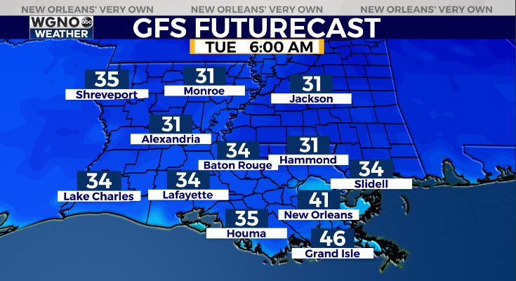
Tuesday, lows drop even more to be below freezing. I am talking coldest weather we have seen through southeast Louisiana since pre-COVID times circa February!
Hurricane Season 2020 officially ends Monday, so some good news there!
Keep up, updates stay available during WGNO’s 10:00 P.M. newscast plus online on WGNO.com!
Check out current conditions near you: https://digital-stage.wgno.com/weather/new-orleans-weather-radar/
Stay up to date with the latest forecast: digital-stage.wgno.com/weather/forecast/
Download the WGNO Weather App to stay connected this hurricane season


