The heat will continue over the next few days as we top out in the mid to upper 90s on Wednesday. At this point it does not look like we see a change in the pattern until the end of the weekend or early next week. That means you need to continue to stay hydrated and drink plenty of fluids along with trying to take breaks if you have to be outside.
There will be another chance of showers and storms Wednesday. This will likely not be widespread but it looks like a few more than Tuesday. That will provide some relief from the heat if you are nearby. The biggest threat from those would be heavy downpours and frequent lightning.
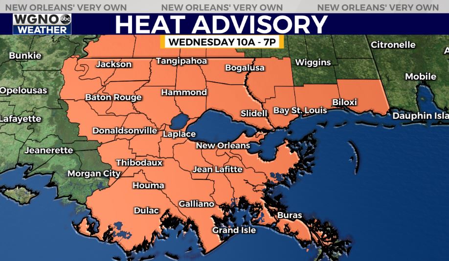
Otherwise the heat will be the big story. By Thursday through the weekend we will see upper 90s for a good portion of the area. Some spots, especially further inland, could see afternoon temperatures at 100 or above. Heat index values will be 110-115 for the second half of the week which means heat advisories or warnings will be likely.


