NEW ORLEANS — Hurricane Nate officially made landfall at the mouth of the Mississippi River Saturday evening. However the main impactful landfall will be along the Mississippi coast Thursday night. Nate’s strength has diminished with winds of 85 mph as it continues to move north at a very quick 20 mph.
The overall threat for Louisiana continues to diminish. Most areas have been removed from the hurricane warning. 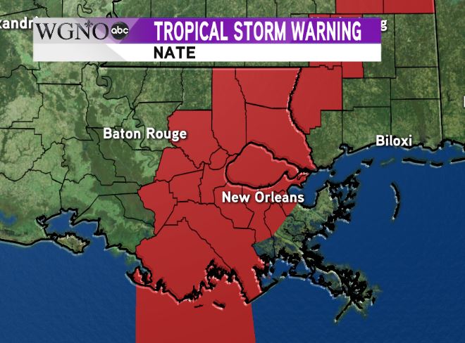 A Tropical Storm Warning remains in effect for central parts of southeast Louisiana. This will most likely be cancelled through the night.
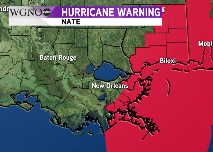 A Hurricane Warning is still in effect for the eastern side of the area including southern Mississippi where the main impacts remain. Keep in mind a Flood Watch also remains for southern Mississippi. At this point we still have the threat of dangerous storm surge and locally heavy rain in these areas, as well as damaging wind gusts.
Overall the threat from Nate will diminish as we go through the night.


