Happy June! Once again, the forecast for today across New Orleans and southeast Louisiana is nice and cool with humidity and a few storms keeping temperatures lower!
Afternoon highs were, area-wide, reaching the 80s. Overnight, over both Northshore and Southshore locations, expect 70s on both sides of Lake Pontchartrain!
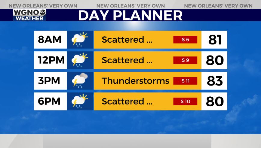
Today to early Monday, there’s the chance we see additional widespread rain chances! Scattered activity cannot be ruled out with each day presenting about a 60% threat of showers through your upcoming week’s start.
Of course, this is going to mean temperatures rise into mostly upper 80s or low 90s by mid-week! Typical forecasts for late June!
Right now, no immediate concerns amid open waters! These next 48 hours look calm as far as potential tropical development, a much welcome change. Now, Claudette is tracking way away from Louisiana, continually moving inland in the south, eventually nearing North Carolina before moving back off of the east coast.
Soak up these gradually warming temperatures while they last and keep up as more information in WGNO.com articles plus each newscast will be available the whole day today. Catch us live during WGNO News at 10PM! Happy official first day of Summer!