Warm and muggy conditions will stick around until a cold front pushes through the area Wednesday morning. That will create the chance for fog tonight and then strong storms on Tuesday.
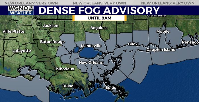
Another dense fog advisory is in effect for much of the area until 8AM Tuesday. It will not be quite as widespread as the past couple of mornings but could still be dense especially near the lakes and coasts so please be careful driving overnight.
The cold front will be moving east through the day on Tuesday. As it does so we will see the chance for storms to develop from late morning through the afternoon. There are ingredients in place for severe weather. Currently along and north of I-10 we have the level 3 threat from the SPC with level 2 to the south. Isolated tornadoes will be possible. We will be watching development to see if we get individual cells ahead of the main line like last time, which would have a higher tornado threat. Please have a way to get warnings in your area and stay weather aware.
Highs will be in the mid 70s Tuesday then low 70s Wednesday. After that cooler and drier air filters in and we see more seasonable conditions come back for the end of the week.