The arctic front is moving south and temperatures will continue falling into Friday morning. Expect cold conditions through the weekend.
A wind chill advisory is in effect for the area Thursday night and Friday behind the cold front. Winds will be gusting into the 30s and 40s and with temperatures in the 20s we could see single digit wind chill values north and teens south. These will be dangerous conditions to be out in for any length of time.
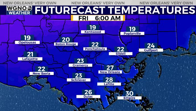
That system will send a blast of arctic air south, plunging temperatures into the 30s for highs on Friday with overnight lows in the teens and 20s.
We will stay very cold all the way through the weekend but with less wind after Friday. Expect hard freeze conditions for a good portion of the area Saturday morning, and then still a hard freeze for areas west and north of New Orleans Sunday and Monday mornings.
You need to be protecting the 4 Ps: people, pets, pipes, and plants.