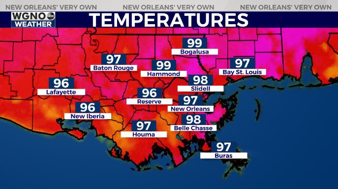
The heat wave continues across the area with today and Saturday being the hottest days this season. Much of the area is already near 100 mid afternoon. Heat index values are near 110 and above. This heat can be dangerous so please continue to stay hydrated and protect yourself.
This pattern will continue through most of the weekend. Afternoon temperatures will reach 98-101 across the area with the highest numbers inland on Saturday.
By late Sunday the ridge of high pressure will weaken enough to allow a bit better chance of afternoon storms. That should at least provide some relief during the afternoon time frame. Next week will look like a more typical summer week with low to mid 90s but for less duration as rain develops in the afternoon.
In the tropics we are watching a wave moving across the Atlantic over the next few days. This is way too early to tell where this system may go at this point. The thing to note is that development in this region usually doesn’t occur until later in the summer, which means this could be an early start to waves coming off of Africa.