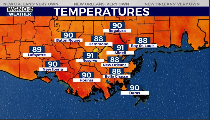
Good Morning, New Orleans! Overnight low temperatures dropped into the 70s along and north of I-12. South of Lake Pontchartrain, temperatures are in the low 70s. Daily high temperatures will remain above average for this time of the year, topping out in the low to mid 90s.
By late Friday, Gulf moisture will pushed into the region helping elevate humidity levels going into the weekend. High temperatures will remain in the 90s, but once the humidity returns it will feel more like the upper 90s.
Expect mostly sunny skies through this Friday with a very low chance for rain. Rain chances stay slim through the week at only 10 to 20 percent to account for isolated afternoon showers.
In the tropics, we continue to track Hurricane Fiona, located in the Caribbean as it continues approaching the open water once again. As of now, the storm has maximum sustained winds of 90 miles per hour (mph).
The system continues to organize and strengthen despite dry air and high wind shear in the vicinity — two factors that typically limit tropical development. The storm is forecast to gradually strengthen over the next few days as it moves westward toward Bermuda.
Nonetheless, locally, we’ll stay nice and quiet!