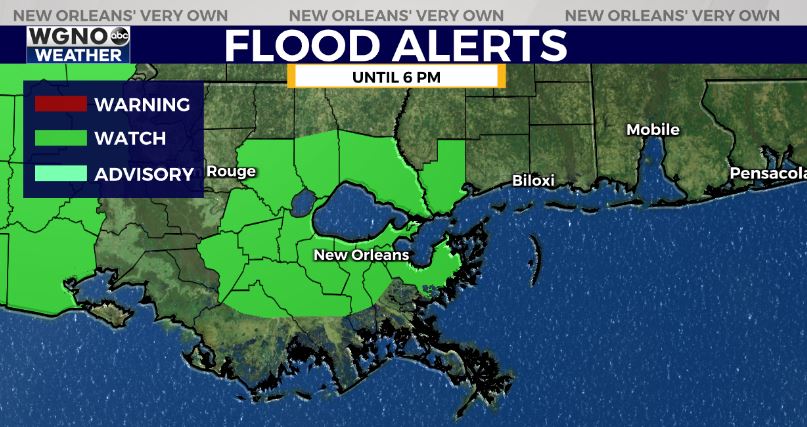
A flash flood watch is in effect along the I-10 and I-12 corridors through Friday evening with a front lingering over the area. We will see waves of rain coming through with some locally heavy rain and storms developing. Right now this looks like an isolated threat but will need to be watched through the day. There could also be a few strong storms with gusty winds.
A stalled frontal boundary over the area will also create a range of temperatures. Areas north of the front like the I-55 corridor will see mostly 60s through the day with areas ahead of the front including the south shore and MS in the mid to upper 70s.
Look for another wave of rain tonight and Saturday morning with drier weather later Saturday. Sunday will be dry and cool with temperatures mostly in the 60s through the day.