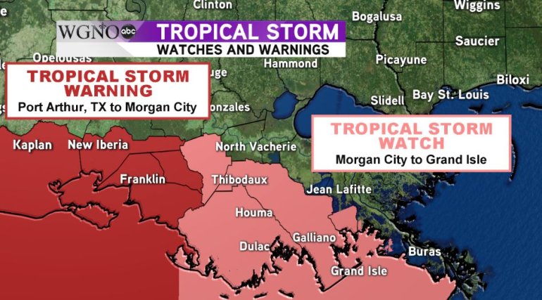
NEW ORLEANS – As Tropical Storm Harvey churns in the Gulf of Mexico, a tropical storm watch and warning has been issued for portions of the Louisiana Coastline.
A tropical storm watch is in effect from Morgan City eastward to Grand Isle. A tropical storm watch means tropical storm force winds are possible in the watch area within 36 hours.
A tropical storm warning is in effect from Port Arthur, TX eastward to Morgan City. A tropical storm warning means tropical storm force winds are expected in the warning area within 36 hours.
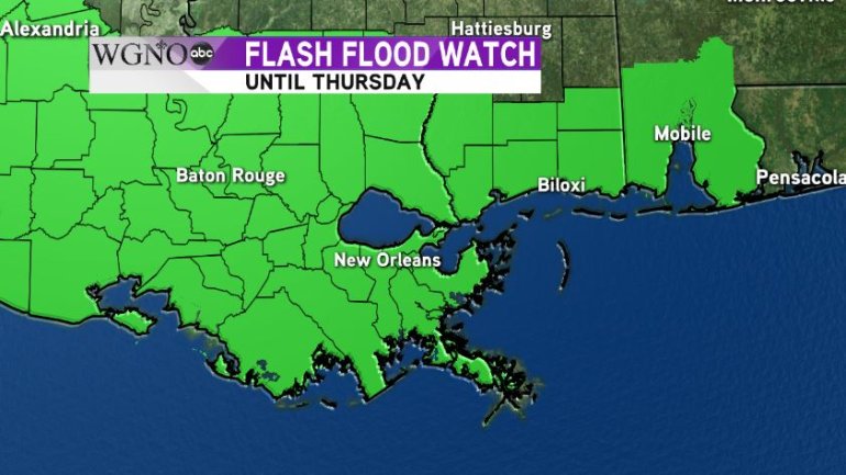
While the wind threat is growing for the coast due to Harvey’s second landfall, the greater threat for the region remains torrential rains from the outer bands that could cause damaging floods.
A flash flood watch remains in effect for our entire viewing area until Thursday. More than two inches of rain has already fallen across most of the south shore and more is expected through the day and night as Harvey continues to inch closer to the coast.
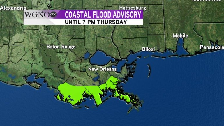
The flood threat along the coast won’t just be from the rain, however. Due to a steady onshore flow of 20-30 mph winds, a coastal flood advisory is in effect for the coasts of Terrebonne, Lafourche, Jefferson and Plaquemines Parishes.
Through Thursday, tides may be up to 2 feet above average which could cause flooding in these coastal areas.
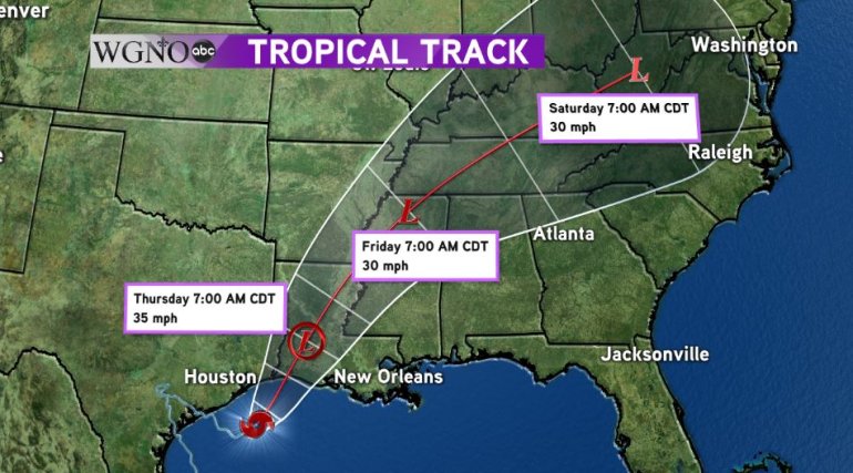
Harvey is expected to make landfall again on the Southwest Louisiana coast south of Lake Charles and move northeast through the center of the state. By Thursday, Harvey will finally be picked up by an incoming trough and move quickly out of the region, reaching West Virginia by Saturday morning.
As Harvey leaves the Southeastern U.S., our forecast will return to a more summer like pattern with scattered showers and storms with highs in the middle to upper 80s for the Labor Day Weekend.