Well, I am officially sounding like a broken record given consecutive blazing highs each afternoon on tap all week!
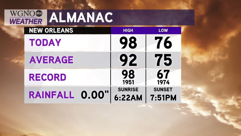
Today, we were tied with our standing one set August 4, 1951.
Earlier, New Orleans International Airport reached 98 degrees, and that same trend remains within our forecast for 24 more hours.
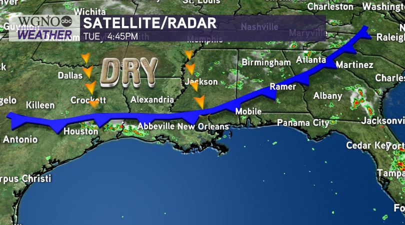
Based off of dry air dominating, southeast Louisiana stays hot with afternoon heat indices in the 100-105 range through at least Thursday.
Humidity values are, area-wide, less oppressive, though, keeping real feels nearer actual temperatures.
Any brief relief will come alongside scattered thunderstorm development, threatening scattered rain in neighborhoods, lightning, gusty winds, etc. Always have ways you can receive watch information on hand.
Gulf of Mexico waters continually remain quiet, too, as National Hurricane Center Meteorologists currently monitor very minimal development chances these next five days.
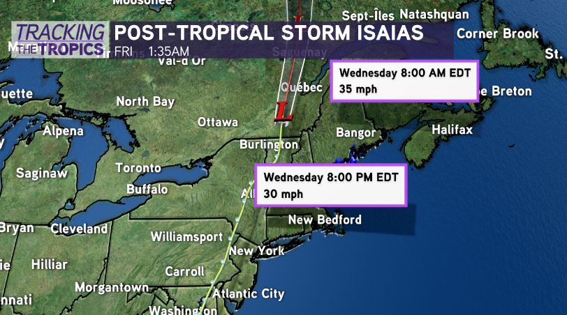
Isaias is moving out American states, heading toward Canada.
Further east, National Hurricane Center meteorologists keep watching minor chances for formation because tropical waves still roll into open Atlantic waters. Right now, no local threats or impacts expected.
Finishing outdoor exercise sooner than later will be best Wednesday given repeated conditions!