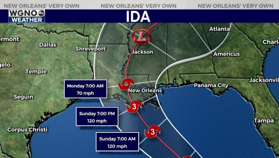
The latest update from the National Hurricane Center Friday morning has Ida making landfall as a category 3 storm winds of 120 mph. This certainly looks reasonable based on a lot of the forecast models, which actually have the storm stronger than that. It will be a key to see how well the core holds together as it moves over Cuba, but rapid intensification is possible as it moves through the Gulf. A category 4 storm is possible.
We should expect significant impacts from this storm in our area. However this does not look like a worst case scenario. The good news in terms of storm surge is that the system will not have a bunch of time over the water to build up levels. This will prevent us from likely seeing catastrophic storm surge. Right now most of the coast is forecast at 7-11 feet, which means flooding likely outside the levee system.
One of the other big issues with Ida will be the heavy rain. Look for a potential of 10-15 inches across the area with isolated higher amounts possible.
Wind speeds will be gusting into the 80s and 90s as this storm moves through. That combined with heavy rain amounts means power outages will be likely. If you are staying home you should prepare for several days if not more than a week without power.
Isolated tornadoes will be possible east of the center as well, especially farther east.
Make your preparations now and be ready for significant impacts to the local area.