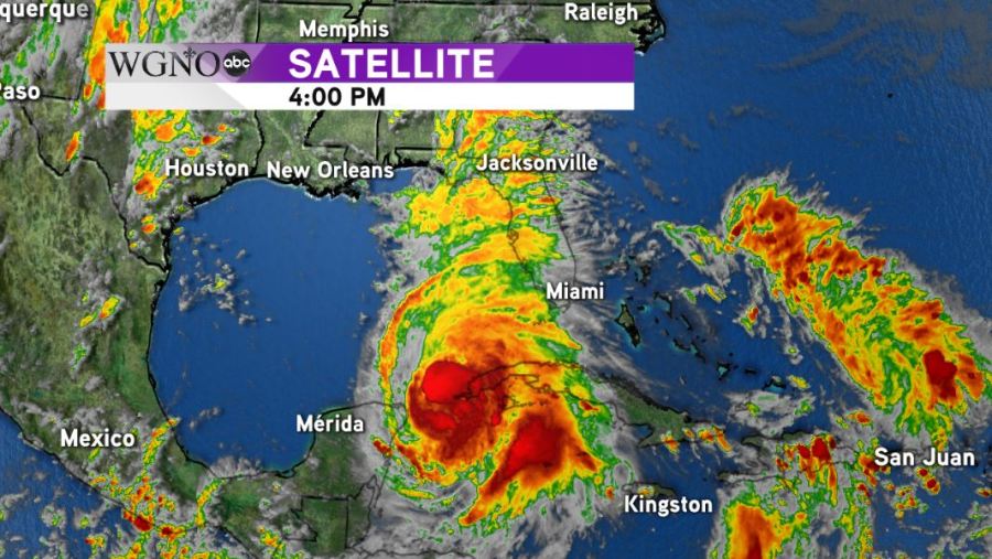
Hurricane Michael continues to push towards the Gulf of Mexico and looks to continue its trend of rapidly strengthening. As of the 4pm CDT advisory Monday evening, Michael was a category 1 hurricane with maximum sustained winds of 80 mph.
Michael is still wobbling in the northern Caribbean, on the brink of entering the Gulf and a more northward motion is expected to develop in the overnight hours and throughout Tuesday before an approaching cold front begins to push the hurricane northeast into the Florida Panhandle.
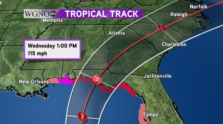
Hurricane warnings are in effect from the Alabama/Florida state line to the Suwanee River along Florida’s Big Bend. A hurricane watch is in effect for coastal Alabama and a tropical storm watch is in effect for coastal Mississippi.
Michael is expected to intensify into a category 3 storm, a major hurricane, before making landfall near Panama City, Florida. Catastrophic damage from storm surge and winds are expected near and east of where the center of the storm makes landfall and widespread damage is likely to trek a path into Southwest Georgia on Thursday before quickly moving through the Carolinas and out into the Atlantic Ocean on Friday.
The WGNO weather team will continue to monitor the latest information on Hurricane Michael and will continue to bring you the latest updates on-air, online, and on social media.