Hurricane Nicholas made landfall around 12:30AM Tuesday in the eastern part of the Matagorda Peninsula in Texas. This storm will really come to a crawl over the next couple of days as it crosses into Louisiana. The remnant low will slow move into southeast Louisiana on Thursday. Locally heavy rain ahead of it will be the main issue.
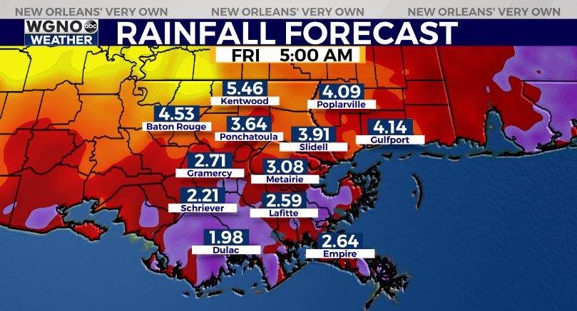
Rainfall amounts could range anywhere from 3-6 inches across the area. Some models are showing up to 10 inches of rain which could certainly be an issue. With the ground being so saturated any pockets of heavy rain could lead to street flooding.
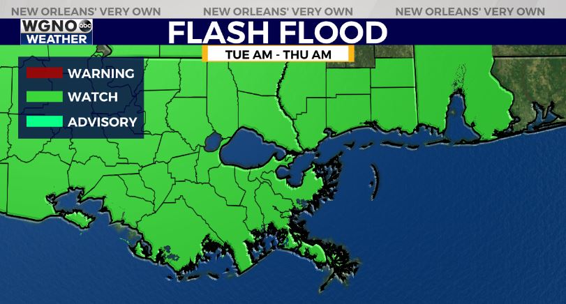
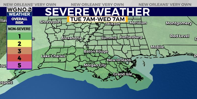
A flash flood watch is effect through early Thursday. Rain looks to be the main issue with this storm overall. On the smaller scaled will be the potential for isolated tornadoes. We have a low end tornado risk today and tomorrow from the SPC.
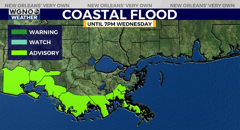
We will also not see a lot of wind or storm surge with this system. Right now there is a coastal flood advisory to the south as tide levels will be around 1-1.5 feet above normal.
Stay weather aware over the next couple of days and as always if you come across a flooded road turn around and find another way to go.