The forecast for New Orleans and southeast Louisiana is stifling and will be all day Tuesday. Be intentional in staying hydrated, staying indoors in the air conditioning when possible, and wearing lighter colors plus sunscreen. Remember to look before you lock, as well.
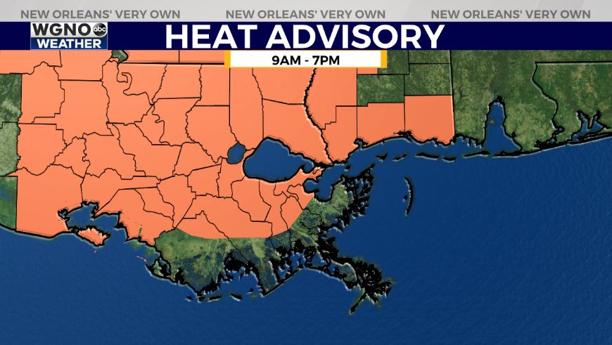
Highs, themselves, will reach upper 90s if not 100s again but feel like 100s during even the early evening. A Heat Advisory is issued until 7PM across our state and Mississippi’s Gulf Coast. Overnight, over both sides of Lake Pontchartrain, expect 70s.
Tomorrow to early this week, we continue seeing heat but it comes with an increase in rain chances for brief relief! 60% or 70% chances remain the theme. I do not anticipate a Heat Advisory once more from 9AM until 7PM Wednesday as widespread storms help provide brief relief from the heat.
Right now, no local concerns as the Gulf of of Mexico heats up based off of these weekend temperatures. We are keeping an eye on three areas for formation potential with moderate development chances this coming week.
Join in for forecast updates and the latest track information on WGNO News at 5PM, 6PM, and 10PM.