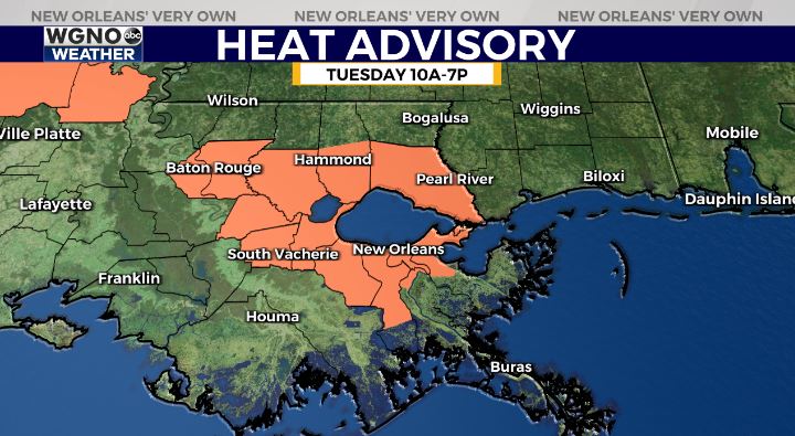
Today will be the hottest of our week as feels like temperatures reach triple digits across a few spots. A Heat Advisory is issued until 7p.m. tonight in areas shaded orange.
An area of low pressure has low development chances in the northern Gulf of Mexico, partially related to a decaying front currently located over the southeastern United States.
Any development of this system is expected to be slow to occur while it drifts just offshore of the northern Gulf of Mexico coastline throughout this week. The National Hurricane Center gives this system a 30 percent chance of formation over the next 5 days. Right now, high pressure over Texas looks more likely to dominate and steer the heaviest rainfall away from our WGNO viewing area.
Regardless of development, heavy rains will be possible along portions of the northern Gulf coastline from Louisiana to the Florida Panhandle over the next several days. Currently, though, heaviest downpours look to stay offshore.
Rain chances will remain elevated at 60 to 80 percent all week. No single day will be a washout, but heavy downpours will be possible with any storms that pop up.
Minor flooding will be possible for Southeast Louisiana where some locations may receive between 3 and 5 inches of rainfall between now and late week.
With the extra cloud cover and higher rain chances, temperatures will likely stay cooler with mid to upper 80s for highs each day.