NEW ORLEANS — Tropical Storm Harvey continues to strengthen as expect while moving through the western Gulf of Mexico. The latest update from the National Hurricane Center at 7 a.m. Thursday morning had winds at 60 mph. Additional strengthening is likely before landfall.
The track of Harvey is looking fairly certain as it moves to Texas, however after that is where most of the questions will come in as we move into early next week. 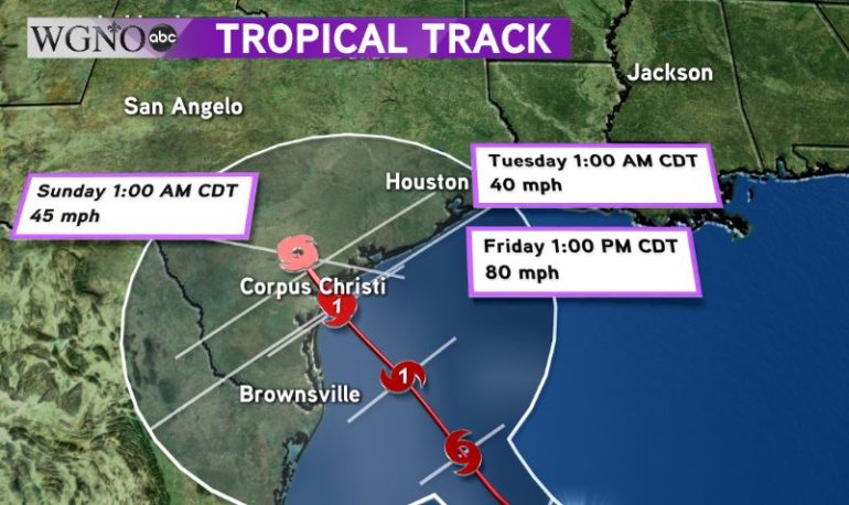 Notice how on the latest projection from the NHC the Tuesday location is almost identical to the Saturday location. At this point it looks like Harvey will remain over southern Texas for at least a couple of days before moving back offshore in the northwestern Gulf.
At that point there are still several options, as designated by the large area of uncertainty in the track forecast. There is the potential Harvey drifts southwest towards Mexico, however the more likely scenario is that it moves northeast to western Louisiana.
If that does occur then we could see heavy rainfall on the eastern side of the storm. There would also be a tornado threat for southern Louisiana and southern Mississippi. The track would be critical at that point to determine where the heaviest rain would fall.
Right now this is a storm that needs to be watched. The most likely impact to our area would be the potential for heavy rain that causes flooding. There’s also the potential the heaviest rain stays west and north.
We will continue to watch this closely. It will take several days for Harvey to move away from Texas. Stay with WGNO on-air and online.


