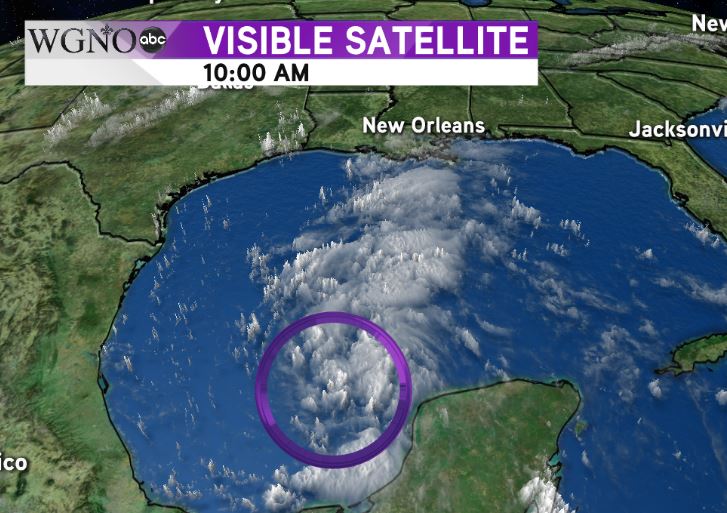
NEW ORLEANS – Tropical Depression Harvey was named Wednesday morning as the system that once was a tropical storm re-strengthened in the southern Gulf of Mexico.
It is currently disorganized, but should strengthen more as it moves through the western Gulf.
This will be an unusual system due to how much it slows down once it moves inland.
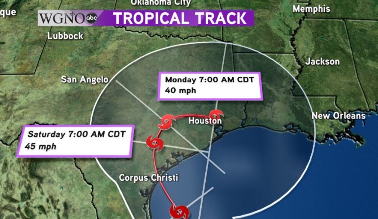
The official track of the National Hurricane Center at the moment takes this in to southern Texas near Corpus Christi. That looks like a likely scenario at this point.
After that, this storm is really going to slow down. It may move very little over a two day stretch and produce extremely large rainfall totals in eastern Texas and potentially western Louisiana.
After that is where the bigger question lies.
The potential future of the storm is still up in the air heading into early next week. If a trough picks up the system it most likely moves it through central Louisiana. If not, it’s possible it could move east along the coast or even back offshore to the south.
Right now, the biggest impact to our area looks to be heavy rain.
With the ground already saturated from a wet summer the flooding threat would certainly exist with additional heavy rain. A secondary threat could include isolated tornadoes as it typical on the eastern side of a tropical system.
It is still too early to tell exactly where the storm will move by early next week.
The important thing to remember right now is this will not be initially impacting our area at landfall. However, the threat for flooding will exist due to heavy rain by early next week.
As always stay with WGNO on-air and online for the latest.