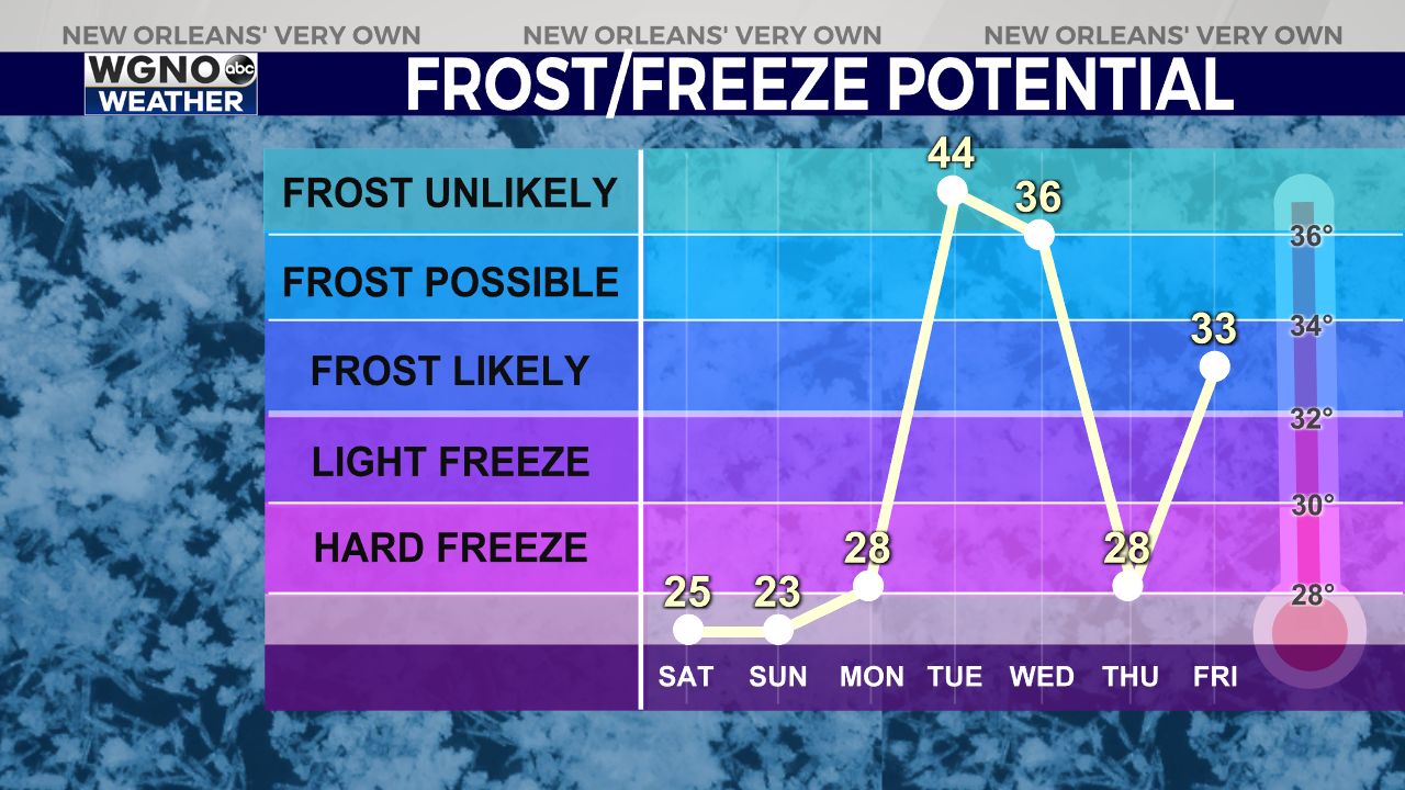
Temperatures struggled to get out of the 30s across South Louisiana and the Mississippi Coast this afternoon, and the air will only get colder from here. Overnight lows drop into the lower 30s for the southshore and into the lower and mid 20s for locations north and west of Lake Pontchartrain.
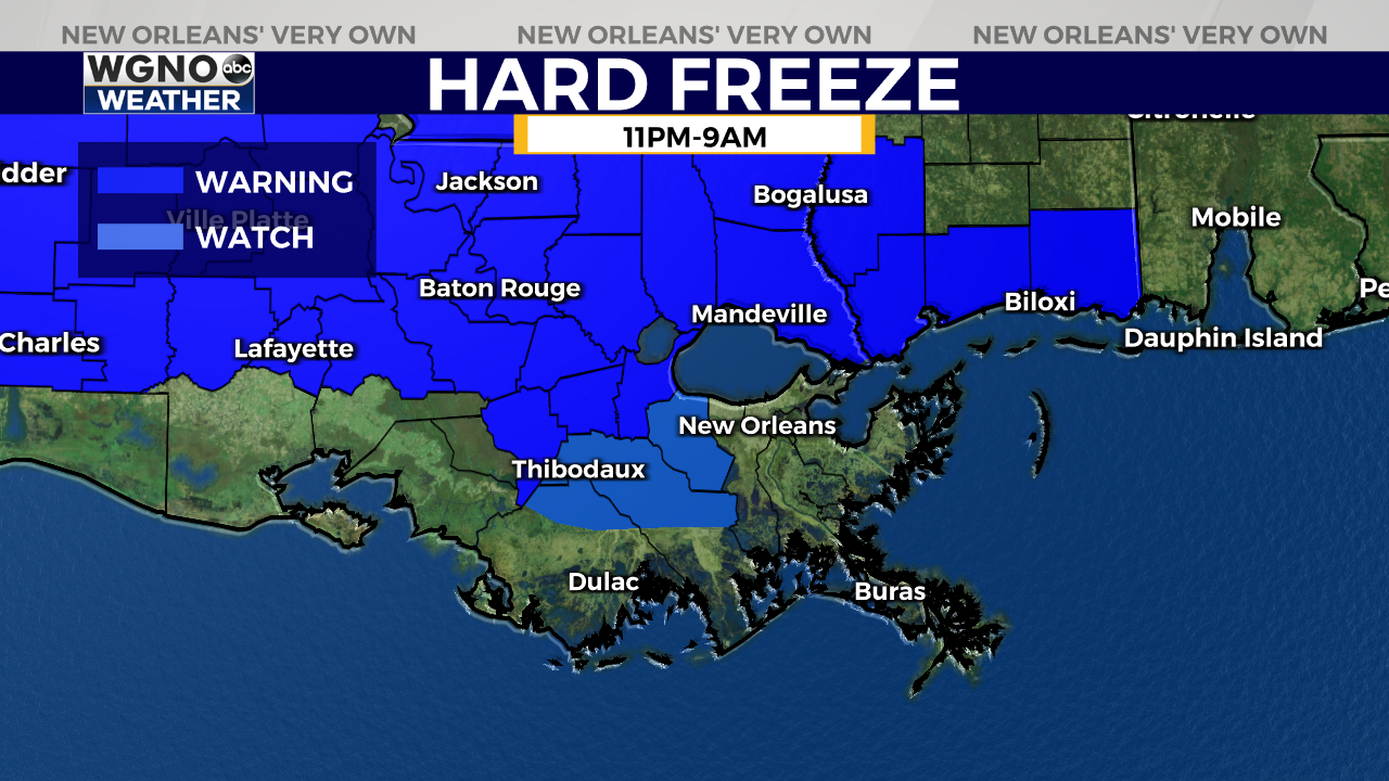
A Hard Freeze Warning is in effect for parishes west of Lake Pontchartrain and most areas north of I-10, including South Mississippi from 11 PM Friday through 9 AM Saturday. A Hard Freeze Warning is issued when temperatures in the lower to mid 20s are expected. Elsewhere, south of I-10, a Freeze Warning is in effect where temperatures could drop as low as 30 degrees.
These are the spots where people, pets, plants, and pipes need to be protected.
Factoring in the wind, it will feel even colder. Winds are expected to remain elevated at 10 to 15 miles per hour with gusts up to 25 mph through the afternoon Saturday. Wind chill or “feels-like temperatures” will be in the upper teens to lower 20s across the region.
After clouds clear late tonight, we will see sunshine return by Saturday morning. Clear skies will continue through the weekend, but high temperatures will stay cool – only topping out in the low to mid 50s. Similar conditions with slightly warmer temperatures are in store for Sunday.


