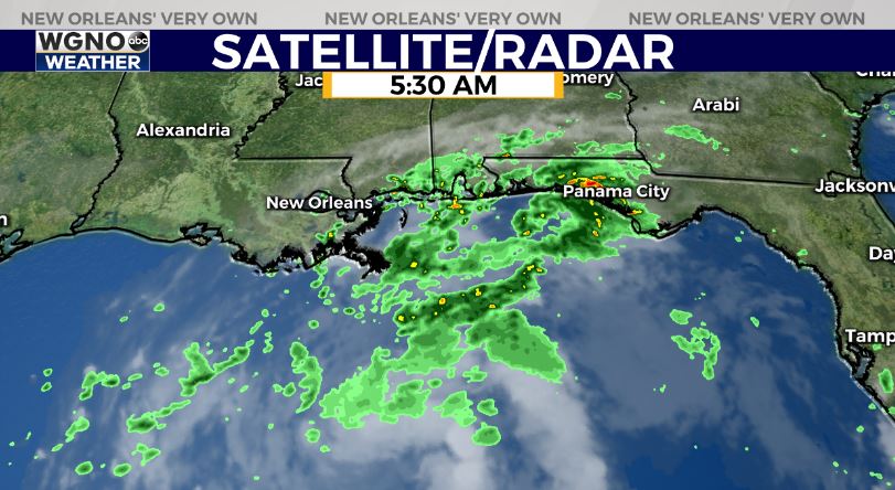
We have one more day of relatively high rain chances before a cold front moves in and continues to push the moisture associated with a tropical wave in the Gulf to the east. Showers and a few storms are already developing early Wednesday morning.
The low in the Gulf now has a 50% chance of developing into a tropical system over the next 2-5 days. Any development though will stay well off to our east.
Look for spotty showers and storms around the area today. Temperatures will stay in the mid to upper 80s through the afternoon.
By Thursday the front is pushing through. This will drop dewpoints from the mid 70s to the upper 50s and low 60s. That means much drier and more comfortable air. Afternoon temperatures will still be hot around 90 but overnight lows will be mainly in the 60s outside of the metro New Orleans area.