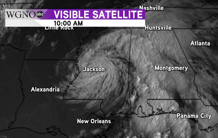
The low associated with Gordon was spinning over Jackson, MS at 10 AM on Wednesday morning after quickly moving inland post landfall.
The dry air getting pulled into the system was causing mostly sunny skies early in the day across southeast Louisiana and southern Mississippi.

Because the band has continued to move east through the morning the Flash Flood Watch has been cancelled for our area in southern Mississippi.
At this point we will not see any additional impacts from Gordon as it continues to slowly move northwest, although expect a good chance of showers and storms on Thursday.