Cold air continues to move in Sunday night and we are already seeing western areas down around freezing. The rest of the area will continue to see those temperatures fall. This will be the coldest night in quite a while and because of that a freeze warning is in effect for a good portion of the area.
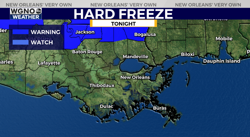
A hard freeze warning is now in effect for areas near the Mississippi border. Temperatures could briefly drop below 28 in these spots.
A freeze warning is in effect for the rest of the area.
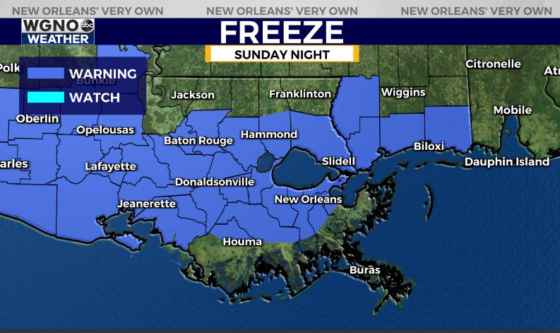
Temperatures will range from the upper 20s to low 30s for a good portion of the warning area. We will likely stay just above freezing in the immediate New Orleans area along I-10. It’s a good idea to protect any sensitive plants along with making sure the pets are warm.
Monday will be chilly but sunny with highs only in the low 50s at best. Most of the day will be in the 40s. Look for another cold night Monday night before we start to warm up a bit through the middle of the week.


