Good Morning! Be careful heading out this AM with patchy fog around a lot of areas. Another Dense Fog Advisory is issued until 10AM throughout southeast Louisiana and along the Mississippi Gulf Coast.
The forecast for your Friday will be warm as temperatures reach 80s by this afternoon after lunch. There’s the chance we break a record high if topping 81 degrees.
Tonight, anticipate 60s on both sides of Lake Pontchartrain, then the rain chances return on Election Day.
Once again, a line of storms will roll through late Saturday morning, early Saturday afternoon on radar. This is going to happen out ahead of the front.
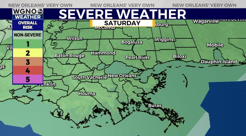
The Storm Prediction Center is issuing a Level 1/5 Marginal Risk for severe thunderstorms, so have a way to receive warning information on hand.
Temperatures will reach the upper 70s before falling into the 60s and 50s once that front has passed. Overnight, you can anticipate 40s on the Northshore again when waking up Sunday morning. Sunday will be beautiful as temperatures top out in the 60s.
We’ll have more information on WGNO News at 11AM.


