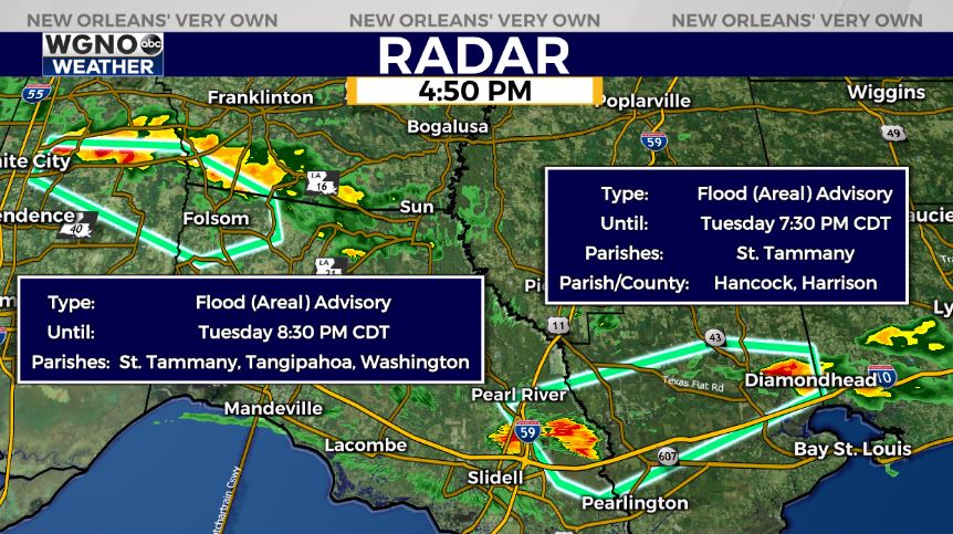
An Areal Flood Advisory is issued for parts of St. Tammany Parish, Hancock County, and Harrison County until 7:30PM tonight as heavy rain in the area continues falling quickly. Additionally, an Areal Flood Advisory is issued for parts of St. Tammany Parish, Tangipahoa, and Washington Parishes until 8:30PM.
Once again, the forecast for today across New Orleans and southeast Louisiana is cooler with humidity and a number of storms keeping temperatures lower across each side of Lake Pontchartrain!
Right now, the city’s restriction on neutral ground parking is lifted throughout Orleans through 8AM Wednesday.
Maintain caution on the roads if you must travel and remember our go to phrase “turn around, don’t drown.” Street flooding will be the major concern in addition to gusty winds and a number of lightning strikes.
Feels like conditions are now within 70s or 80s. Afternoon highs reached the upper 80s, but overnight, over both sides of Lake Pontchartrain, expect 70s. When the sun peaks out fully, it is hot.
This afternoon and evening into much of the coming week, there’s the chance we see additional scattered rain chances! 40% or 50% chances remain the theme. Tomorrow, showers for brief relief are a little more isolated, near 30% of the area can expect rain. This is because a front already made its way through our region, bringing temperatures down and rain chances up. Humidity will be below average, too, as dewpoints remain in the 60s or low 70s.
Beyond this morning, most rain chances remain daytime heating driven throughout the hottest part of your afternoon after lunch.
Stay tuned as more information in WGNO.com articles plus each newscast will be available the whole night tonight!