Once again, the forecast for today across New Orleans and southeast Louisiana is cooler with humidity and a number of storms keeping temperatures lower across each side of Lake Pontchartrain!
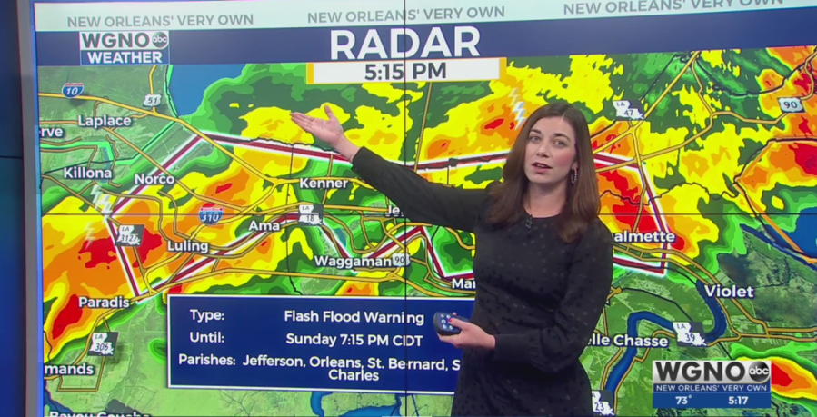
Right now, the city’s restriction on neutral ground parking is lifted throughout because a Flash Flood Warning remains in effect until 7:15PM.
Maintain caution on the roads if you must travel and remember our go to phrase “turn around, don’t drown.” Street flooding will be the major concern in addition to gusty winds and lightning.
Afternoon reached the upper 80s or 90s once again today. Overnight, over both Northshore and Southshore locations, expect 70s on both sides of Lake Pontchartrain.
Monday, there’s the chance we see additional widespread rain chances! Scattered activity cannot be ruled out with about a 40% threat of storms. Watch for localized heavy downpours that could lead to street flooding in some areas, much like we are seeing now.
Of course, this is going to mean temperatures rise into mostly upper 80s or low 90s all week, feeling much hotter! Typical forecasts for July!
The tropics are currently quiet with minimal development potential into next week! We are not complaining!
Stay tuned as more information in WGNO.com articles plus each newscast will be available the whole night tonight! Catch us live during WGNO News at 10PM after the NBA game!