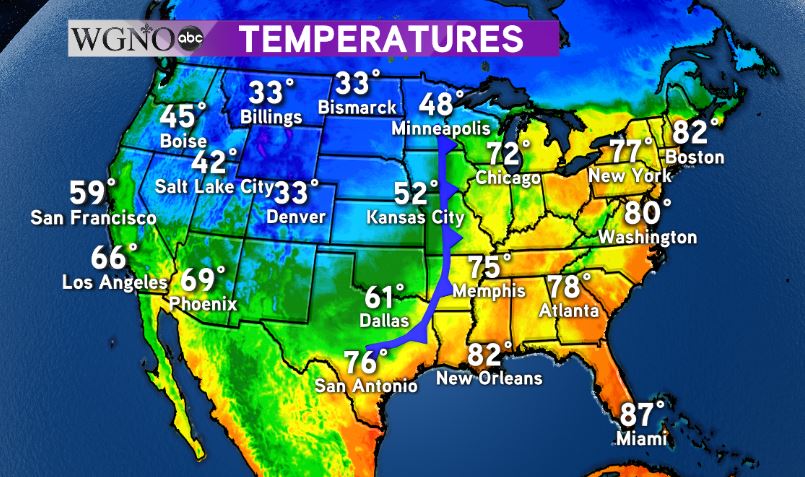
At noon Wednesday a cold front was beginning to move into northwestern Louisiana. This front will bring the first fall airmass to the area over the next couple of days.
Temperatures out ahead of the front remain warm with widespread 70s and 80s. However they quickly drop into the 60s across northern Texas.
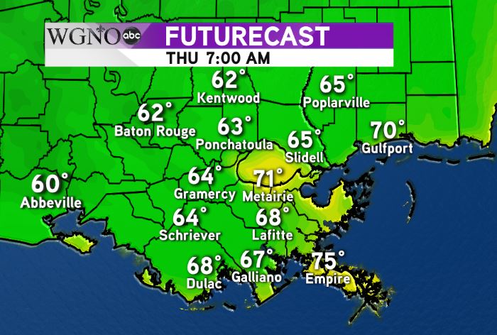
Cooler and drier air will be moving southeast starting tonight and into Thursday. While afternoons will be cooler, the biggest difference will be with the morning lows.
Even cooler mornings are on the way by Friday and Saturday as we see 50s for portions of the area.
Look for mild afternoons with highs around 80 Friday and Saturday with low humidity.
Right now it looks like another front will be moving in by Tuesday to reinforce the fall air.