The forecast for New Orleans and southeast Louisiana is stifling and will be all day today.
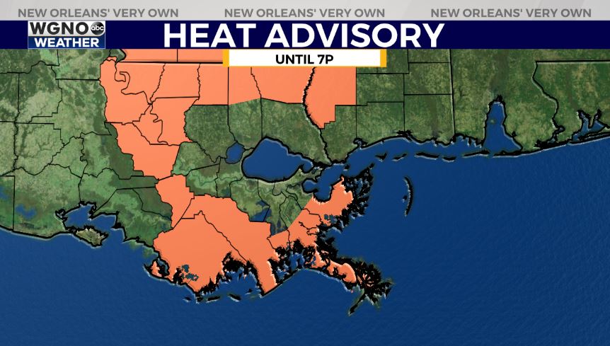
Highs, themselves, will reach upper 90s again but feel more like 100s during the hottest part of your day Saturday. An Excessive Heat Warning is issued, which means index values are nearing 113+ in many spots. A Heat Advisory is issued, as well, until 7PM. Overnight, over both sides of Lake Pontchartrain, expect 70s.
Tomorrow to late weekend, we continue seeing little rain for brief relief from heat! 20% or 30% chances remain the theme.
This weekend, high pressure remains over the area before pushing south, so temperatures are scorching. Anticipate a heat advisory once more Sunday with criteria meeting heat index values between 105 and 110+ degrees.
With this ridge pushing south, Grace will remain well below Louisiana as it tracks back into Mexico.
Henri is the season’s eighth named storm and will impact the East Coast by Sunday.
Join in for forecast updates and the latest track information on WGNO News at 6PM and 10PM.


