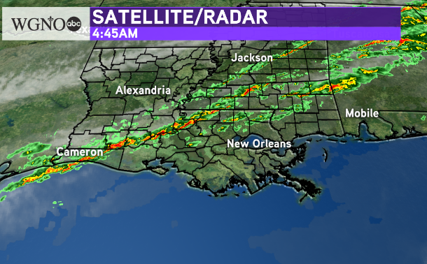
A cold front is moving through Louisiana early Wednesday morning with rain ahead of it. This area of rain with a few storms will continue to move southeast as we go through the early morning hours.

Right now most of this activity does not have lightning with it but there are some heavier downpours in the areas of red and yellow.
This line will continue pushing south through the morning and will be in metro New Orleans around 9-10. The line will push near the coast by noon meaning most of the area will be dry by that point.
In terms of travel if you are driving regionally expect rain to continue to move east across the southeastern U.S. Behind the front though conditions are good.
Temperatures are slightly cooler behind this front. After mid 70s this morning we will see upper 60s through the rest of the day.


