Temperatures will be chilly again tonight, but not as cold as the last couple of nights. Temperatures are forecast to drop into the upper 30s for areas north and west of Lake Pontchartrain, while locations south of the lake stay a touch warmer in the lower 40s.
Tuesday the warm-up continues as high temperatures return to the mid or upper 60s for most. This will bring us closer to our average high temperature for mid-February, which is about 68 degrees.
Wednesday and Thursday will be even warmer – but it comes with a high chance for rain.
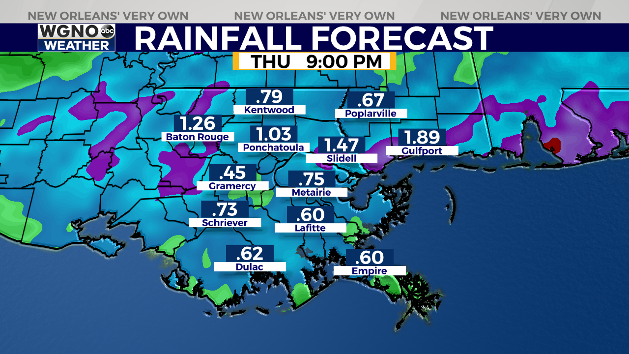
The latest models show scattered showers in the second half of the day Wednesday with widespread rain (and some thunderstorms) on Thursday. Rain chances are at about 20% during the afternoon Wednesday before increasing to 50% Wednesday night.
On Thursday, rain chances are close to 100% as a storm system moves across the Gulf Coast states ahead of a cold front. This system may bring a low-end risk for strong or severe storms, but it is still too early to pinpoint exact timing or what the threats may be. Regardless, everyone should be prepared for heavy rainfall and gusty winds Thursday into Thursday evening.
Heading into Friday, the rain and moisture clears out and colder air arrives. Highs Friday only top out in the mid 50s, but expect temperatures to quickly rebound into the mid 60s by Sunday.