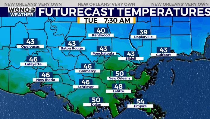
We are seeing cooler weather to start the week and that trend will stick around for the next couple of days. Expect chilly conditions tonight with most of the area in the low to mid 40s by Tuesday morning except spots near the lake and coast where we stay around 50. Some of the cooler spots farther north of I-12 may even briefly see the upper 30s. Expect more of the same Tuesday night.
The next couple of days will be on the cool side but pleasant with plenty of sun and low humidity. Highs will be in the mid 60s Tuesday and upper 60s Wednesday.
Mid to upper 70s come back Thursday into Friday ahead of another cold front. This front looks potent with a good chance of rain across the area on Friday and then temps struggling to get out of the 50s over the weekend.


