
Rain is moving across the area Thursday morning as the big cold front moves in from the west. Temperatures were in the 50s and 60s ahead of the front but only in the 40s and eventually 30s behind it. This will mean falling temperatures through the day and it will be much colder this afternoon as winds pick up out of the northwest.
Rain will be ending by mid morning as that cold air moves in. Another system will move across the region tonight with another chance of precipitation. This is the system that will bring at least a small chance of some freezing rain or sleet overnight.
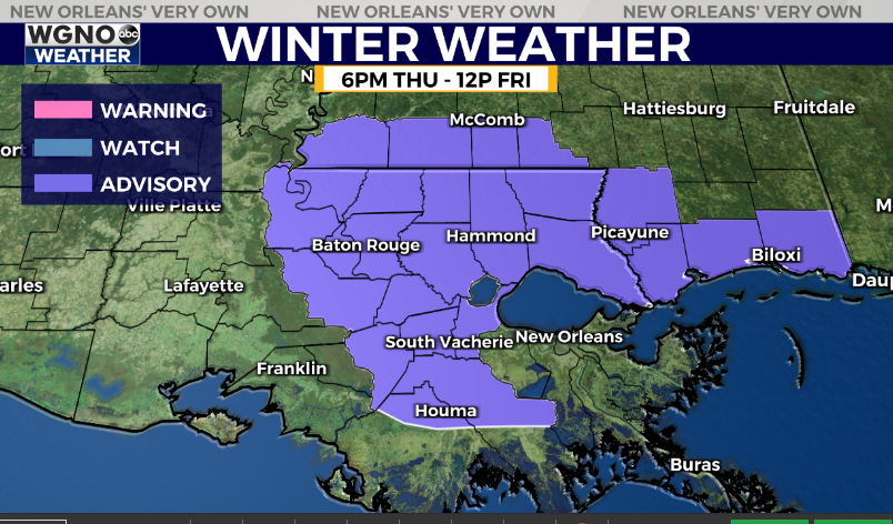
The National Weather Service has issued a Winter Weather Advisory for a good portion of the area through tonight and Friday morning. This is where we could see temperatures cold enough to produce sleet or freezing rain. The latest trends have been to push the precip south before most of the area gets to freezing. We likely will not have widespread ice issues, however these areas could see at least light freezing rain before the moisture moves out. At the very least it’s something to keep an eye on over the next 24 hours.
After that Friday stays dry but cold with mid 40s. Look for upper 20s by Saturday and Sunday morning to the north and we could see a hard freeze in those areas on Sunday morning. The weekend will be cool but sunny with low to mid 50s.


