Happy Sunday! Low rain chances, unseasonal heat, and clouds are back once again in your forecast for these next few afternoons. Yesterday, we were far warmer than usual during late October!
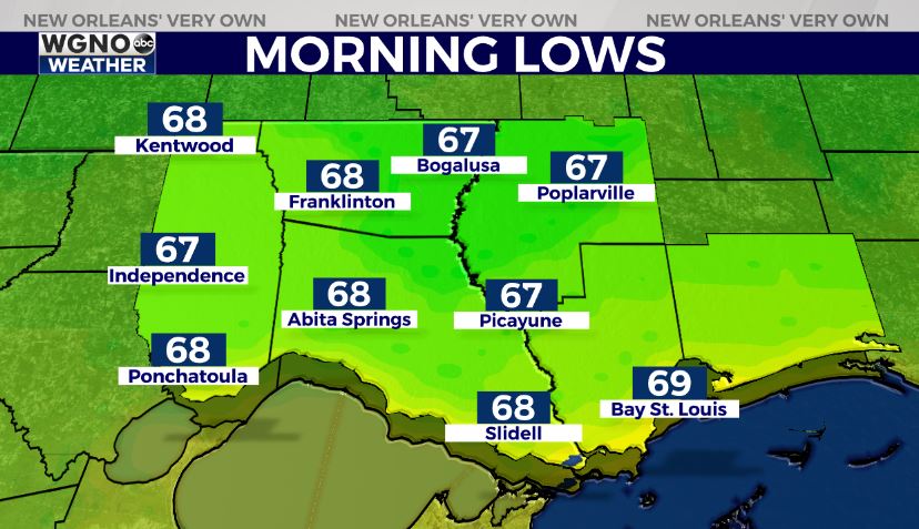
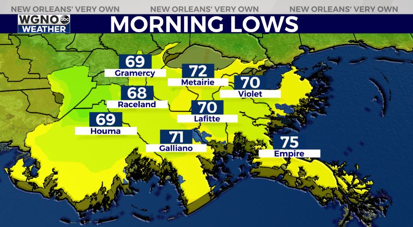
Overnight, over Northshore locations, 60s will be the theme with 70s south!
Mid week, we see another pattern change with one more real cold front moving through, bringing fall back again in southeast Louisiana. At that point, heavy downpours could lead to possible street flood advisories, so have a way you can receive warning information on hand. This is also likely posing widespread severe threats with damaging winds, hail, and isolated tornadoes possible.
Already, the Storm Prediction Center has issued a level 2/5 Slight Risk for much of Louisiana’s, Mississippi’s, Alabama’s, and Florida’s Gulf Coast region. Severe storms will likely accompany the boundary pushing through Wednesday morning through afternoon before it continues pushing east.
The weather behind it will be beautiful and far more fall-like just in time for Halloween. At that point, 50s and 60s finally return once again, so something to celebrate!
We’ll have more information on WGNO News at 5PM and 10PM.


