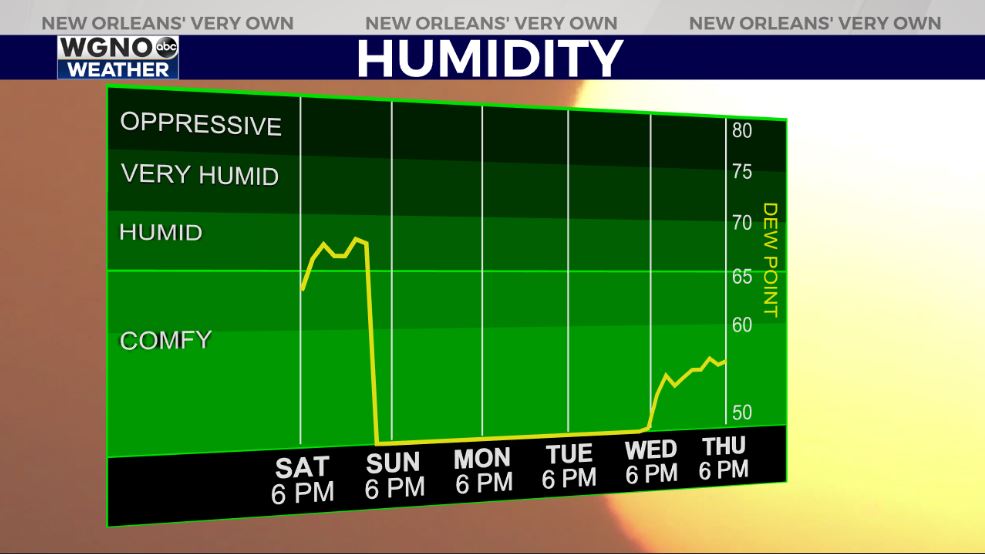
What a gorgeous weekend we are sharing across New Orleans! Earlier today, afternoon highs reached 81 degrees, but another cold front will roll through again tomorrow to lower temperatures and humidity!
Fog may be becoming an issue tonight until early Monday, nonetheless, few storms will accompany the boundary.
Overnight, over Northshore locations, temperatures remain steady as residents wake up with mid 60s outside while Southshore residents wake up with upper 60s. This is not the case given our forecast for Monday AM, though!
Dry air will be behind Sunday’s air mass, sticking around for foreseeable days ahead! Climate Prediction Center outlooks show conditions stay average during your upcoming week! We have one more front arriving Tuesday, as well.
Our high forecasts for this upcoming week equate to tonight’s lows: upper 60s, low 70s!
Remember, Hurricane Season 2020 does not end until November 30th. Yes, yesterday the National Hurricane Center named another tropical storm: Iota.
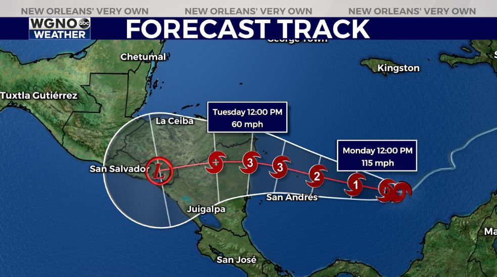
Iota will increase in strength, making landfall across Central America, likely as a major hurricane. Remember, this is when storms reach Category 3, 4, or 5 intensity in open water, achieving 111+ mile per hour wind speeds.
Unfortunately, Caribbean environments do support intensification on tap. Right now, this is no immanent concern here locally but worth closely watching, regardless!
Keep up, updates will be accessible online on WGNO.com and through our WGNO Weather App!
Enjoy our upcoming forecast for GUMBO WEATHER!
Check out current conditions near you: https://digital-stage.wgno.com/weather/new-orleans-weather-radar/
Stay up to date with the latest forecast: digital-stage.wgno.com/weather/forecast/
Download the WGNO Weather App to stay connected this hurricane season


