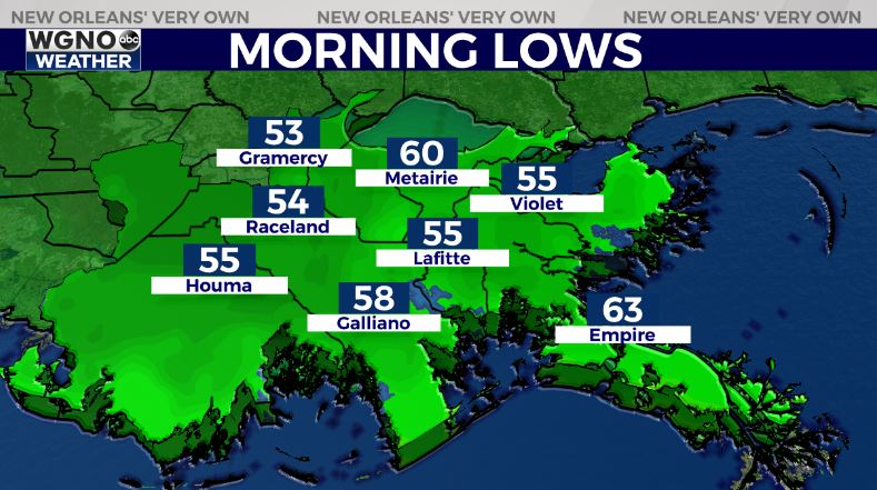
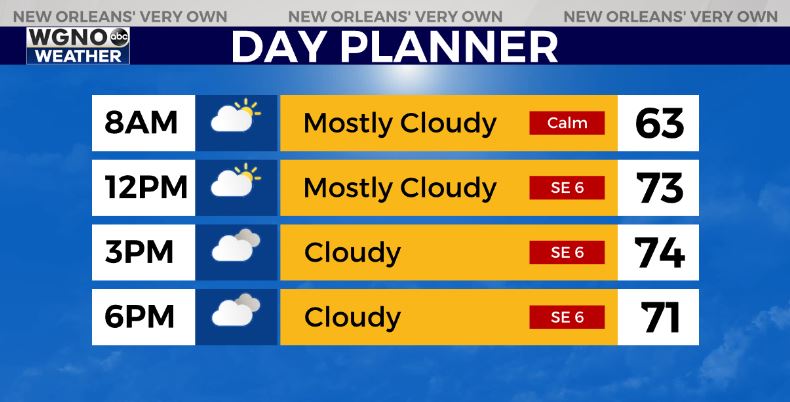
Cloud cover will help to keep temperatures warmer tonight with low to mid-50s on the south shore and upper 40s to around 50 north. Expect clouds again for your Wednesday with highs back in the mid-70s.
It still looks like a cold front will move through Thursday evening.
Right now rain looks pretty limited with this system so just expect some scattered showers with a couple of thunderstorms. Highs will be in the upper 70s.
There are some indications that on Friday we see another brief round of showers pop up as the main upper-level trough swings through. After that we clear out for the weekend with cooler weather moving in. Saturday looks like the coolest day with highs only in the mid 60s. Details will likely change though over the next few days.


