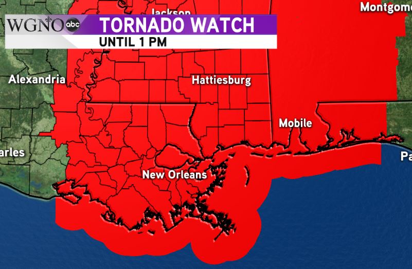
NEW ORLEANS – The entire area and much of the lower Mississippi River valley is under a Tornado Watch Thursday until 1 p.m.
As we saw on Wednesday, there is a chance that cells formed east of Cindy can rotate and produce tornadoes in the area.
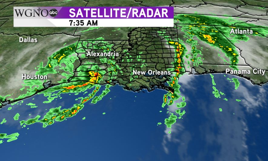
Cindy made landfall early Thursday morning along the coast between Cameron, Louisiana and Port Arthur, Texas. As it moves inland, it will continue to produce scattered storms on the eastern side of the storm.
Right now, most of this activity will be contained within a few rain bands. Under those bands, flash flooding is a threat. For the rest of the area, just isolated showers and storms are expected, with the strong ones containing a tornado threat.
Strong onshore flow will also continue through Thursday night, meaning the coastal flooding will not start to improve until Friday.