10:00PM
—
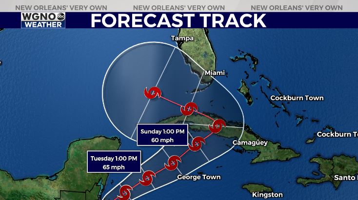
National Hurricane Center’s 9PM advisory’s a bit different but remains largely unchanged as it brings Eta into the Gulf of Mexico by late this weekend, early next week.

Right now, no one in Louisiana should be concerned about immanent local threats. Closely monitoring updates, however, will be beneficial as long-range forecast details should begin surfacing tomorrow to Saturday.
At that point, rain chances go up across our region. Temperatures warm into upper 70s late next week during your afternoon after lunch.
5:30PM
According to National Hurricane Center’s latest advisory, Eta’s path has shifted after land interaction in Cuba. This is going to mean the system will track into Gulf of Mexico waters by late this weekend, early next week.

Right now, no immanent threats locally are a concern, but we’ll continue watching it closely. Spaghetti models have begun to agree Eta’s track may be beginning to move further east.
Friday into Saturday, conditions will stay nice, but rain chances are area-wide possibilities. Temperatures stay mild and seasonal, slowly warming into upper 70s by next weekend.
—
11:30 AM
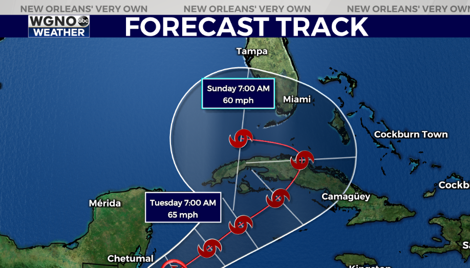
The track for Eta has shifted some after Cuba. This brings the storm into the southeastern Gulf of Mexico.

This is something we will watch very closely over the next few days. A storm moving northwest from the eastern Gulf is certainly possible.
In the meantime the forecast will be mild the next few days and still include spotty showers over the weekend, mainly on Saturday.
—
7:00 AM
A remarkable run of beautiful weather will come to an end heading into the weekend as rain chances come back.
For your Thursday expect mild temperatures in the mid 70s. More clouds will be moving in though so less sun than the past few days.
Humidity will also start to move back in which will keep overnight lows much warmer over the next week.
A west-moving tropical wave in the northern Gulf will bring ring to the area on Saturday. Look for scattered showers with also a chance for a thunderstorm. A few showers could linger into Sunday as well.

We will continue to monitor Eta over the next few days as well. This will likely strengthen as it moves back over the Caribbean. A turn to the west near Florida will be possible and while it does not look like an issue here at the moment we will need to watch it into Monday.
Check out current conditions near you: https://digital-stage.wgno.com/weather/new-orleans-weather-radar/
Stay up to date with the latest forecast: digital-stage.wgno.com/weather/forecast/
Download the WGNO Weather App to stay connected this hurricane season


