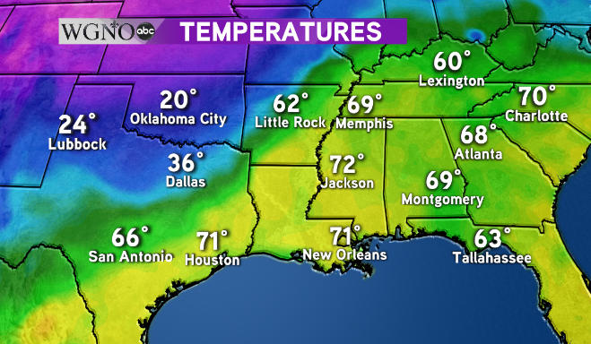
Colder weather is on the way after a week of spring-like weather that saw fog, humidity, and record highs. A cold front currently working across the middle of the country is bringing drastic changes behind it.
Dallas is already down 30 degrees behind the front mid-morning on Thursday. The area of warm air out ahead of it will continue to get pushed out by the colder air behind it. That will make for one more day of near-record highs across southeast Louisiana and southern Mississippi.
The front will not be a big rainmaker. 
One that band of rain moves through temperatures will fall quickly as winds switch from the south to the north and northwest. Look for breezy and cooler weather overnight tonight. 
Colder spots to the north can expect lows in the upper 30s by Saturday morning.
As always stay with WGNO on air and online for the latest.