Good Morning, New Orleans as a very active weather day begins. We are, area-wide, certainly waking up warm given temperatures in the upper 70s with signifcant humidity.
Right now, winds are out of the south, so moisture is pumping off of the Gulf, adding to mugginess and humidity. This is making it feel even warmer.
This afternoon after lunch, expect sustained winds to be in the teens or twenties with gusts into the thirties at times. At that point, temperatures will reach the upper 70s to low 80s on both sides of Lake Pontchartrain.
By peak commute time, rain chances will increase considerably. Localized heavy rain will lead to possible street flooding concerns. Rainfall amounts will be between 2-4 inches in the next 24 hours or so.
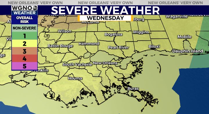
The Storm Prediction Center is issuing a Slight Risk (Level 2/5) for severe thunderstorms across the WGNO viewing area Wednesday. We see a main line come through late tonight to early Thursday, but there will be localized heavy downpours out ahead of this. Greatest risks include extremely heavy downpours and straight line wind concerns with low tornado threats.
Have a way you can receive warning information on hand, and think about possibly altering commute plans when getting off of work and school.
We’ll have more information on WGNO News all day today.


