A rare early August shot of low humidity will be moving in tonight through Thursday bringing more comfortable conditions with it.
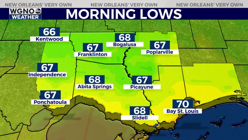
You will really notice this during the morning hours on Thursday as we see lows dropping into the mid to upper 60s in the northern areas. Look for low to mid-70s south.
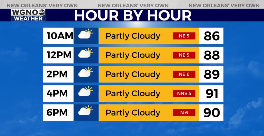
Thursday will stay hot with highs in the low 90s but the humidity will be low with plenty of sun.
That humidity starts to come back on Friday as we get back into the low 90s and dewpoints get back into the 70s. This will lead to isolated storms developing. Look for the summer pattern to continue through the weekend.
Highs will be in the low to mid-90s each day with showers and storms popping up in a spotty fashion late morning through the afternoon.


