A much cooler weekend is on the way as another cold front moves through overnight. Temperatures will stay in the 60s this evening ahead of the front. After the front moves through expect temperatures to fall and winds to pick up out of the north. This should be after midnight into early Saturday morning.
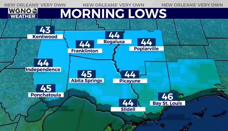
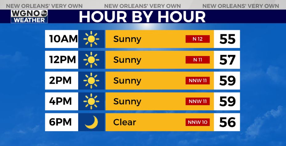
Lows will drop into the low to mid-40s north and upper 40s to low 50s south by early Saturday. Temperatures will not warm much though through the day and struggle to reach 60 by the afternoon. We will see breezy conditions through the day as well with clear skies.
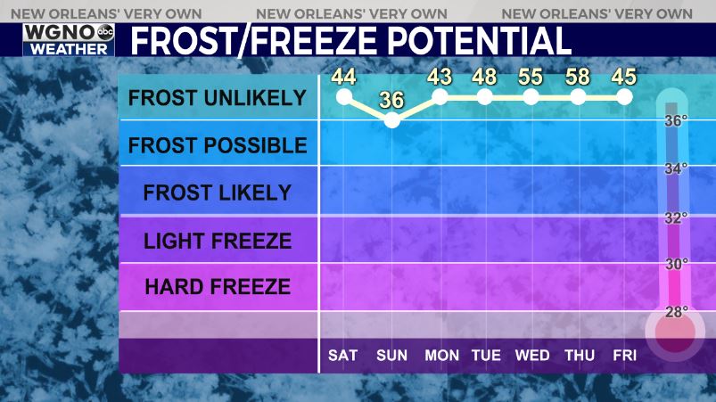
The coldest morning of the season so far looks to be Sunday morning. Temperatures will drop into the mid and upper 30s to the north with isolated frost possible. Expect low 40s south. After that look for a sunny Sunday in the upper 60s.
We will stay dry into early next week as temperatures continue to warm up.