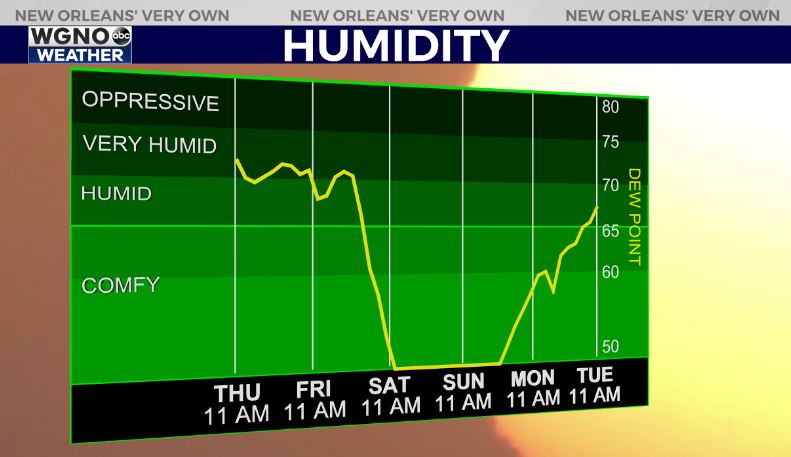
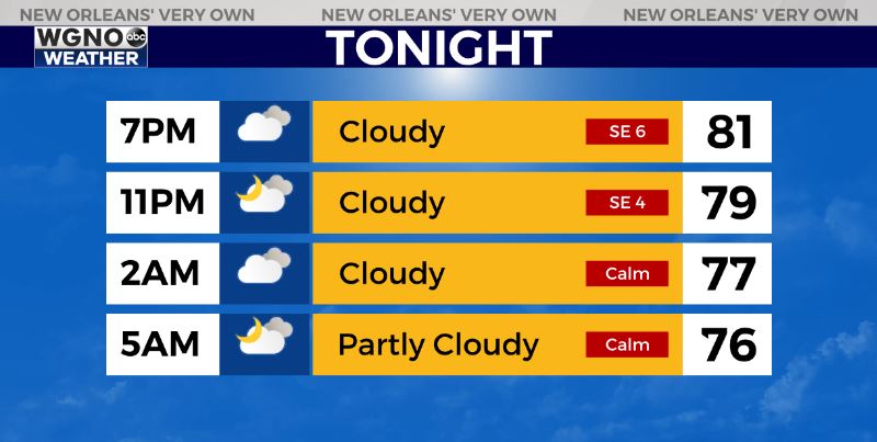
One more day of the late summer feel for Friday before the big cold front comes in over the weekend. We will stay warm and muggy tonight with temperatures only dropping into the low to mid-70s. Fog will be possible in areas that see clearing but overall it looks like quite a bit of cloud cover.
Expect spotty showers during the day on Friday. Temperatures will warm into the mid and upper 80s through the afternoon. Humidity will also be high for one more day. It looks like the front comes through early Saturday before sunrise. Once that pushes through big-time changes will move in.

Look for winds to increase out of the north on Saturday as temperatures only warm into the mid-70s. Lows will drop into the low 50s north and upper 50s south both Sunday and Monday morning. If the winds calm down enough a couple spots in the upper 40s will be possible.