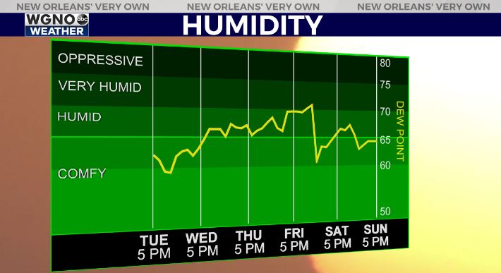
Patchy fog will be possible tonight as the humidity levels stay high. Look for either a layer of clouds to form or in some cases fog at ground level. Some of that fog could be dense in spots.
Humidity will continue on the high side through Saturday as several rounds of rain move through. A drop follows the Saturday system which should allow for a drier Sunday.
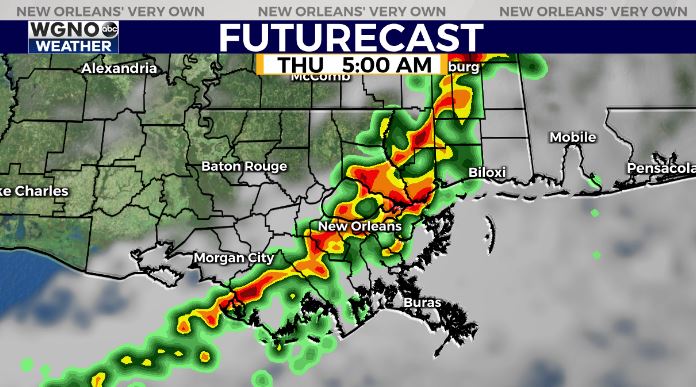
The first good rain chance comes in late Wednesday night and Thursday morning. Look for a band of rain and storms across the area. Some storms could be on the strong side.
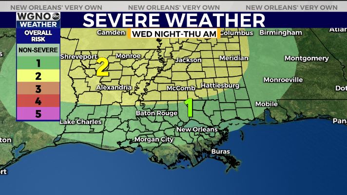
A low end severe weather threat is in place across the area. While not likely, the line could produce an isolated severe wind gust or tornado threat. Small hail will also be possible.
This system moves out by mid morning Thursday but scattered showers will be possible again Thursday afternoon and Friday. The heaviest area of rain will be the system early Saturday.