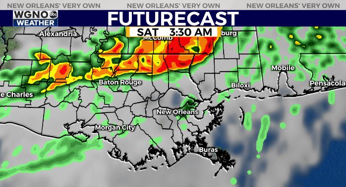
A warm night is on the way as the humidity that was pushed south earlier this morning starts to move back north. This sets the stage for a warm and muggy day Friday ahead of another round of storms that will be moving through the area.
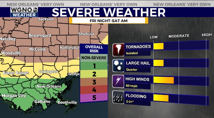
The key thing to know right now is we are expecting the chance for more storms and the possibility of severe weather Friday night into Saturday morning. Models have been disagreeing on the exact timing and placement of the stronger storms.

Right now it looks like we will see a similar situation as Thursday morning where a line of intense storms moves through the area. This will contain a damaging wind threat as well as the chance for isolated tornadoes.

This line will be moving across the area early Saturday and likely start to focus more to the east as it does so.

The storm prediction center currently has the far northern part of the area near the MS border under a level 3 threat for severe weather. The rest of the north shore and southern MS is under the level 2 threat.
As always please have a way to get warnings if they are issued for your area. Since this is another potentially overnight event make sure your phones are charged and will wake you up in the event of a warning.
Stay with us on air and online at WGNO and download our news app as well.


