A strong cold front is pushing through southeast Louisiana and southern Mississippi this evening. This will bring a shot a much cooler air as we head into the Easter weekend.
Right now temperatures are dropping into the 50s and 60s behind the front. Winds are also picking up out of the north and we have a Wind Advisory in effect for the area tonight and tomorrow morning.
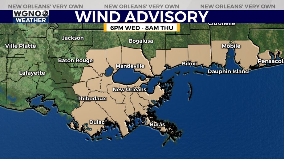
Look for winds in the 20s with gusts in the 30s at times.
We will also see much cooler temperatures tonight.
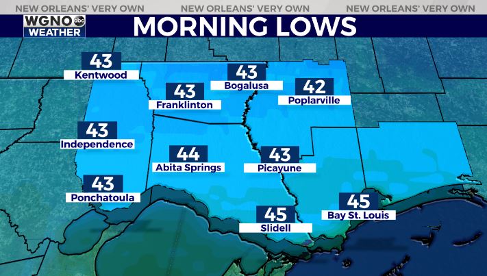
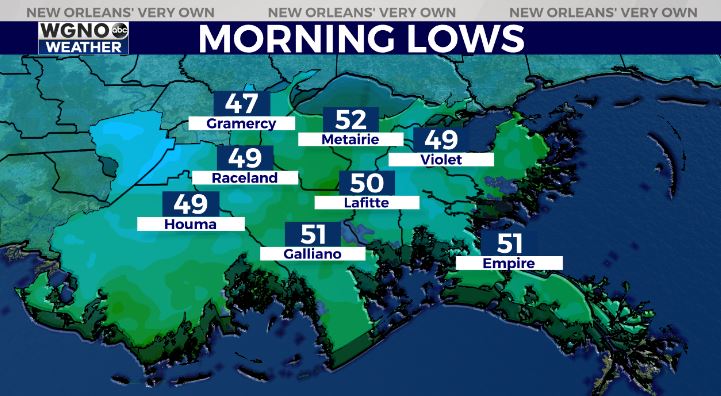
Look for lows in the low to mid 40s north with upper 40s to low 50s south. Even colder temperatures will move in by Friday morning with some areas in the mid 30s.
Check out current conditions near you: digital-stage.wgno.com/weather/maps-and-radar/
Stay up to date with the latest forecast: digital-stage.wgno.com/weather/forecast/
Download the WGNO Weather App to stay connected this hurricane season


