7:00AM VIDEO FORECAST — Risk for strong to severe storms tonight-early Thursday. More storms late week. Here’s the breakdown from Meteorologist Scot Pilie:
![]() Heads Up!
Heads Up!![]() Stormy weather pattern looks to be on the way mid week into the weekend. Several rounds of thunderstorms appear likely with accompanying severe risks.
Stormy weather pattern looks to be on the way mid week into the weekend. Several rounds of thunderstorms appear likely with accompanying severe risks.
It does NOT look like a complete washout of a weekend! In fact, much of Saturday and Sunday don’t look shabby!

Round 1: Arrives Wednesday night-Thursday morning with Marginal Risk(Level 1 out of 5) for severe weather.
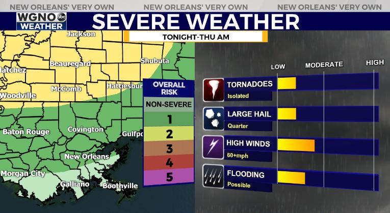
Main risk of gusty winds, small hail, isolated tornado.
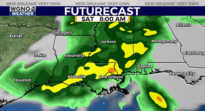
Round 2: Arrives late week with scattered hit/miss storms Friday with a few locally heavy. More robust activity possible Friday night-Saturday morning-mid day. The timeframe & coverage of rain still looks a little unclear, but forecast models indicating drier air arriving by Saturday afternoon!

Primary risks of gusty winds, large hail, & localized heavy rainfall.
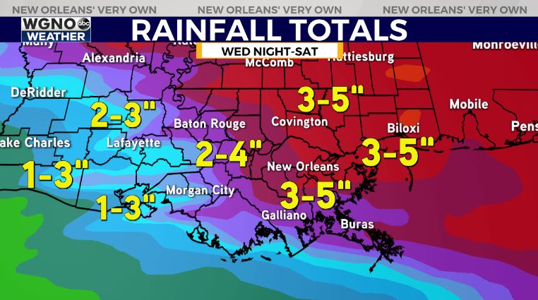
3-5″ of rainfall appears likely between Wednesday-Saturday.Stay tuned as the forecast becomes more fine tuned.


